Up till now, I have been a pilot-who-did-not-own-a-portable-GPS. This meant flying either by dead-reckoning, pilotage and/or radio beacons. Unless if there was a GPS built into the airplanes (which happened many times so far), I did not use GPS and was largely bound to VOR-to-VOR navigation. In hindsight, this kinda stopped my enthusiasm for long cross-country VFR flights deep into foreign territory due to the apparant complexity of their airspace.
This recently changed when I decided to buy a good portable GPS unit which is primarily meant for VFR, but which has some IFR features, notably en-route IFR navigation. I am not a big fan of fumbling on tablets, PDAs or laptops inside a cockpit. I wanted a unit which is meant and designed for aviation use. So I settled on the Aera 500 with a touch screen. I am basically very happy with the unit. The touch screen works nicely but it takes some time to understand menus and features. After an evening of fumbling in the coach at home however, I was confident to use it in the air.
So, armed with a decent GPS unit, I revisited an old dream to fly to the south of France. More precisely I choose to fly onto Rodez (LFCR). The problem with my flying is TIME. Due to my professional and personal duties, it is hard for me to disappear for a couple of days to go flying. This issue limits options, and hence distances flown. However, in the week in between christmas and new year, I had like 4 to 5 days to spare, so it was an ideal time to go flying. But, that week is in the middle of the winter here, which meant that the weather is cold, icy, unstable and that the days are short. All of this pointed towards an IFR flight plan. However, it is increasingly difficult to find FAA registered N-reg airplanes for rent here, a requirement for my IFR flying as my instrument rating is American. As I didn’t find any decent N-reg airplane for rent, I reverted to a VFR-flight-only plan.
So here was my challenge: Fly VFR forth and back from Belgium to south France in the middle of the winter. You have 5 days to make it happen. It must be of course legal and utterly safe.
Preparation
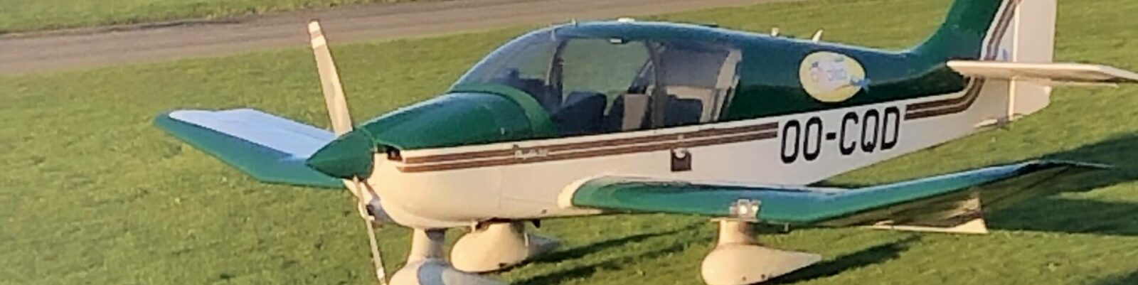
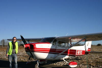
Limited to a VFR machine, I opted for the good old trusted Cessna 172 OO-WVS of the Zoute Aviation Club. I made sure to be as current as I could be by wintertime. There is no built-in GPS, so I was happy to have bought one.
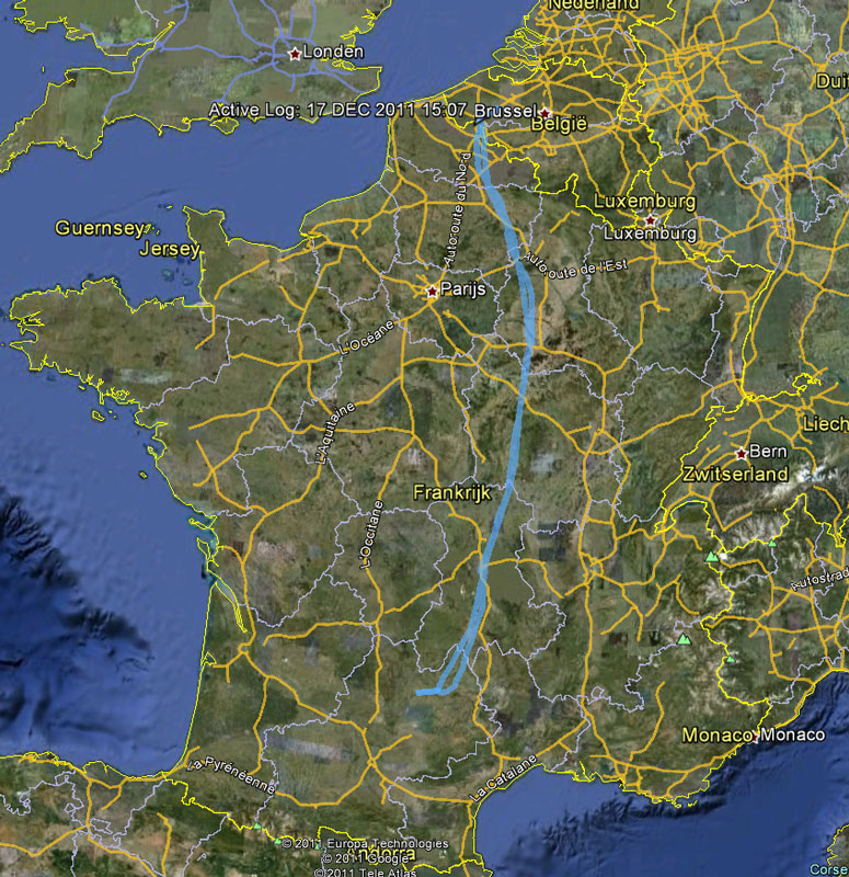
I started preparing well ahead of time. Straight line from Kortrijk to Rodez is over Paris, but VFR flight there is impossible due to Class A airspace blocking Paris. This Class A structure has recently grown but I did not have the right maps yet – the GPS came in very handy. And I did update the maps manually. I wanted to fly my classic VOR-to-VOR as much as possible, partly because I am used to that, partly because I would have a radio backup to my new portable GPS. I checked on the charts and saw that there are two possible routes:
1. The eastern route around Paris
This route is the shortest one, but goes over high terrain (the Massif Central) from Clermont Ferrand onwards. I planned:
EBKT CMB REM TRO MOU CFA MEN LFCR: Kortrijk – Cambrai – Reims – Troyes – Moulins – Clermont-Ferrand – Mende – Rodez
2. The western route around Paris
This route is distinctively longer, but avoids the high terrain as above:
EBKT ABB ROU EVX CHW AMB LMG FC LFCR: Kortrijk – Abbeville – Rouen – Evreux – Chartres – Amboise – Limoges – Figeac – Rodez
I prepared both routes thoroughly.
- Plogs were made with various possibilities for fuel stops (Limoges (LFBL), Blois (LFOQ), Rouen (LFOP) and Troyes (LFQB), Vichy (LFLV), Clermont (LFLC)). I mailed or called the airports for their opening hours in between christmas and new year.
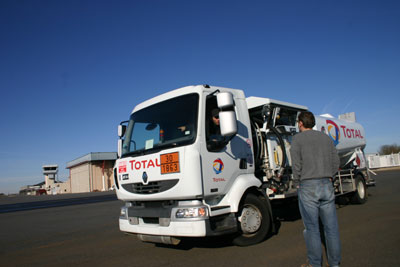
- I ordered an Air Total fuel card, a popular way to refuel AVGAS in France. You do need a French bank account, but if you have that the process is painless, also for renters. They issue a card ‘tous appareils’. The application takes about three weeks. I received my card too late for the trip, but that was my fault.
- I printed all VFR approach charts along both routes from SIA France, and I printed all relevant IFR charts just in case they were needed. I do have a FAA Instrument Rating, skills I could rely on in emergency.
- Checked NOTAMs along both ways via Olivia (password comes for free).
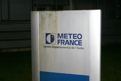
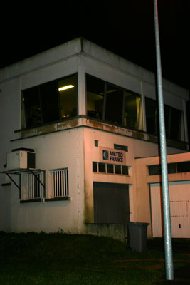
I followed up the weather and its patterns ahead of time via the classic weather website of Meteo France and the Belgian KMI. As soon as the weather during that week became visible in their forecasts, I grew more positive about a positive outcome of my planned trip. It looked like that classic period of cold and warm front blowing in from the west and bringing bad weather, would be interrupted by a rather stable high pressure area settling over France that week. Timing remained unsure.
For weather near to the targetted dates, I added aviation weather into the mix from the French official aviation weather website Aeroweb (password also comes for free), interspersed with more visually oriented weather reports from Orbifly’s Met’Map system: a nice and easy to use tool. However, when the target flight time of the morning of Dec 26th became very near, it became clear that it would be a difficult judgement. The promised high pressure area did not cover Belgium too well, and it brought a lot of moisture from the south which resulted in forecasting of fog and area of widespread drizzle. And that’s what we don’t want when flying VFR, do we?
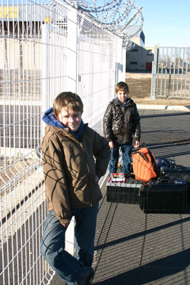
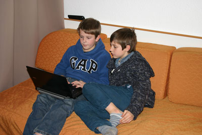
I had invited my son along and his little friend to accompany him. This would be a nice boys trip ! However, Dec 26th came along and the forecast in Lille called for BKN007, and once again this is not VFR. We drove to the airport and loaded the plane, but after waiting for 2hrs, it was very apparant that flying that days would not be happening. We returned utterly disappointed.
First leg: Kortrijk (EBKT) to Rodez (LFRC)
That same day I checked that weather for Dec 27th, and that showed better: lifted broken to scattered ceiling, although fog over central France could be blocking. The next morning Lille showed BKN025, and a VFR departure was possible. I opted for the eastern route because it is hsorter and because the mountains down south were forecast weather free. Moreover, the destination of Rodez, and a very wide area around it, called for CAVOK the whole day. There were low clouds forecast over the middle of France, but I could overfly them with my 50G fuel tanks that give me a total endurance of 6 hrs. This gives me an no-wind endurance into Spain, so enough fuel to reach destination with 2 hrs of spare. Winds were forecast to be mild in the high pressure area. As I needed to fly back later that week, we also looked at the longer time forecast and that showed some promise. So I decided to launch !
I drove back to the airport with my two buddies. I gave them a stern and thorough briefing in the car. We loaded the airplane, unloaded our bladders, fueled up the plane and took off, VFR southbound.
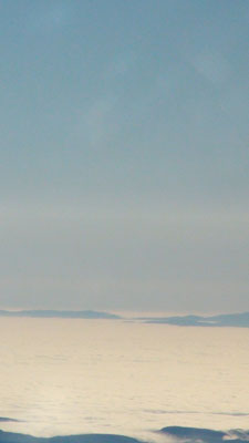
I flew below the broken / scattered clouds over Lille towards Cambrai. Over Lille, I heard my friend on the radio with his Cessna 172RG. He was just taking off, IFR and equally southbound ! This was sheer co-incidence. Somewhat further in between Lille and Cambrai, the clouds opened and I was able to climb further to FL75. Past Cambrai VOR I turned southeast to the Reims VOR and the clouds closed beneath me: I was VFR-over-the-Top !
VFR-over-the-Top means that I was under Visual Flight Rules in Visual Metrological Conditions while clouds were blocking the view of the surface. In case of emergency I had time to consider my options, I was trained to fly in clouds and I had the IFR approach charts of all IFR airports below me in reach. Of course, I knew that I was flying towards perfect weather down south. And I had more than enough fuel to get there. We had plenty of options and was trained and prepared for the emergency.
Being under VFR did force me to carefully manage the airspace: avoid the active military one, obtain the clearance for any possible class B, C or D and of course avoid any class A. Of course, I was talking the whole time to Lille Information, Paris Information, Seine Information etc. And they were extremely helpful. I asked and obtained actual weather briefings for the various stations en-route like Vichy (LFLV), Clermont (LFLC) and my destination Rodez (LFCR). This allowed me to double-check my options. They called traffic for me, and I could overhear them talking to IFR traffic in their capacity of en-route controllers. They were particularly helpful to various pilots who were seeking to find the best option to divert to or land in view of the IMC weather down below.
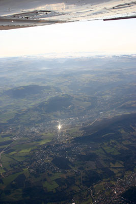
There was a new temporary control zone north of Reims that I had picked up from the NOTAMS and had printed out, and I was happy to see that my GPS was showing it already. A call to Paris Information confirmed its activity, so I avoided it via a diversion of my flight plan on the GPS. Once beyond that, my track changed to a value larger than 180°, so I climbed to FL85. The sight below full of rippled clouds was magnificent. The sun burned into our faces. The boys were reading books, chatted, played on their Nintendo’s. Daddy flew his dream: we had a blast !
Somewhere around Troyes VOR, I was called traffic behind me, 500 ft above at FL 90: a Cessna overtaking me. This was my friend in his Cutlass. We did not talk to one-another in flight over the common frequency, but we called each-other later over the phone to swap stories.
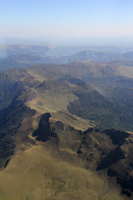
Somewhat south of Moulins VOR, we flew past the Morvan, a rough area in the Burgundy region. Its peaks broke through the cloud layer bathing below us in the low winter sun. We felt priviledged to be able to see this and my two boys savoured the uniqueness of the moment. We approached the highlands of the Massif Central, but its first city, Clermont Ferrand, was still reporting IFR weather. They were literally on the edge of the clouds because once we passed the aiports, all clouds were gone and we could pick up any detail on the ground baking in the sun. Precisely as forecast.
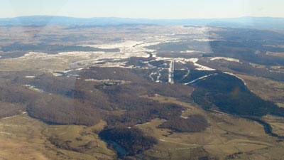
I continued on FL85 towards Mende VOR and once we passed the snowcapped mountains of the Cantal, we turned southwest towards Rodez. Less than one hour to go and so signalled our bladders. We were in contact with Clermont Information and were being transferred to Rodez Information. We passed the ski area near Languiole:
We descended to reach our visual reporting point N north of Rodez at the correct altitude. We were so jolly that we started signing together over the intercom! We flew over the valleys of the Truyère and the Lot. The contrasts thrown by the low sun were magnificent! We rejoined points N and EA and were cleared to join left hand base for runway 31 at Rodez. Having visual on a twin Diamond performing a practise ILS approach, and we were cleared to land. A soft landing ensued and we soon taxied to the stand. We quickly emptied our bladders, tied up the airplane and prepared to walk our luggage to the rental car. I had flown 3h50m over 410NM, that is an average ground speed of 106 knots: not bad for a 1978 vintage Cessna 172, and the longest consecutive time I had spent flying myself.
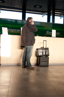
The security at Rodez was slightly convoluted: we had to get passed a narrow turning gate with all our luggage and walk towards the terminal land side to pick up the rental car. I guess that is a by-product of arriving an international airport also served by Air France and Ryanair, next to OO-WVS of course. All went very smoothly, and soon I was driving fat and happy by car with my two buddies towards our final destination.
Second leg: Rodez to Troyes (LFQB)
The next day, I planned to do some local work, or even some local flying. But we got up and checked the weather and I found that that my options to return VFR within my alloted 5 days were getting very limited. I already consumed two days to get there, and weather was closing in rapidly. So I made the bold and annoying decision to return that same afternoon. We packed up in a negative mood. I re-checked the weather and saw that I could make it easily VFR to Vichy, just north of Clermont past the mountains. Beyond that, clouds were coming up, and weather was hitting the VFR limit somewhere around Troyes (LFQB). The western route was worse. I booked a hotel in Troyes, near the airport. And I mentally prepared to duck under the clouds when they appeared to continue towards Troyes as far as safe and possible. The airports of Nevers, Auxerre, Vichy and Moulins were my diversion options, so I kept the plates handy. With full fuel I always had the option to make a 180° and return safely south towards clear weather.
We drove back to the Rodez airport, dropped off the rental car, paid an extremely democratic 9 EUR for landing & parking, dealt with security and fueled the plane. I topped up 109 liter. For my previous day engine time of 4hrs, this meaned an average fuel consumption of 7.2 GPH: not too bad for a 1978 vintage Cessna 172 !
I taxied to holding point A1, did my run-up and backtracked runway 31 for a departure to the north. After take-off, we were given a squawk and remained on the tower frequency for the complete time within Rodez Information area. The crossing of the rivers in the north of the Aveyron were as breath-taking as the day before. It was nice to follow the scenery both on the paper charts as well on the small touch-enabled screen of the portable GPS.
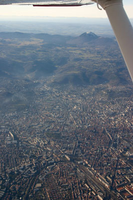
Soon we were passing the high terrain again and we were switched to Clermont Information. I climbed to FL 75. Clermont-Ferrand was CAVOK today but they made me do a small deviation west of the airport due to inbound traffic. I was near but way higher than the Puy-de-Dôme towering over the city in the west.
I started obtaining current weather reports for Troyes and the diversion airports north of my flightpath. I must congratulate French ATC with their willingness to help and think along. They offered me updated reports and mentally helped understanding the weather situation. It became clear that Troyes was improving, but still on the edge. We passed Vichy and started to see the forecast cloud layer in the distance. At Moulins VOR, I descended to get under the clouds. I ducked under at 2500 ft. Clouds were nicely above me. Visiblity was OK.
So we left the sun behind us and continued under the clouds towards Troyes. The GPS showed terrain and I got convinced with its value. Now I started to understand what I had missed in all these years of VFR flying ! Soon, we switched to Troyes Tower and once we were in sight of the airport environment, I was cleared by Troyes Radio to land straight in onto runway 35. They already had their runway lighting on, and it was clear that the VFR weather would not sustain too long.
We taxied to the lonely apron, fueled up and switched off: 249 NM in 2h21m, that is an average groundspeed of 106 knots again and an average fuel consumption of 7.3 GPH. Nice work !
We paid our low landing fees and our fuel already so we would not have to wait for the people to show up the next day in case we needed an early take-off. I also congratulate the airport staff for their perfect service and friendliness. Visit Troyes ! The cherry on the cake was a on-airport France Meteo station that provided us with a personal weather briefing for the next morning. It appeared that my hasty departure of that morning was indeed good planning: if we would leave Troyes early next morning, we would beat the bad weather, forecast to arrive in Lille, around 10~11am. That would allow to make my winter VFR trip in four days of which three in nett flying.
We went by foot to the nearby (300 m) Novotel hotel where we checked in and had a great dinner and a good sleep.
Third leg: Troyes back to Kortrijk
We woke up at 6am and took a healthy breakfast. I checked the weather again on Aeroweb and Orbifly, filed a VFR flightplan over Olivia. I was going to get hefty headwinds, but good visibility. Rain would set in from 10am onwards at Lille. The local sunrise that day was at 8.34am. VFR flight is allowed from 30 min before sunrise, so the plan was to be taking off at or later than 8.04am. Planning was to land back in Kortrijk (EBKT) slightly after 10am, with a possible diversion to Lille (LFQQ).
We checked out from the hotel and walked back in the windy cold to the airplane. The friendly staff had left me entry codes into the airport compound the day before, so I could start my flight without external help. I was also fueled up. I dropped in at the France Meteo station once again to confirm the weather: they were already awake and provided fantastic service!
It was still dark outside. We loaded up the airplane again, did my walk-around with headlight and torchlight like I learned on previous non-JAA night flights, and prepped the airplane. The airport is served with pilot-controlled-lighting (PCL): some microphone clicks on the Troyes Radio frequency, and the lights come on exclusively for me ! We started taxying at 8.04am and I was airborne around 8.10am into the windy but clear winter morning.
Heading north towards Reims at first, and talking already to Seine Information who kindly opened my flight plan. Two kids were already on Nintendo and peering down to the smaller world below who was waking up and preparing for the last days of 2011.
I climbed 4500ft. It took some time to get Paris Information on the frequency, but I learned that they only opened at 9am. I avoided again the temporary miltary area north of Reims. We overflew some old airforce bases near Laon. It appears that the French airforce has built a large number of such bases in the past. Who could help me clarifying ??
I was battling headwinds up to 35 knots! After battling them for a time, we were overflying Lille again. The weather was still OK, so I continued towards Belgium and the airport of Kortrijk. There was a dark stripe and clouds looming over Kortrijk. I descended, joined reporting point Sierra, lefthand downwind for runway 24, and a base near the train tracks brought me on final for runway 24. Given the strong headwind, I could make a slow landing, and we softly settled back on Belgian soil.
It started to rain in the taxi to the hangar, and soon the airport was engulfed in rainshowers. I had succesfully finished a winter flight of more than 400 NM to the south of France in Visual Metrologic Conditions and in full safety! I was proud, but I understood the value of my FAA Instrument Rating more than everyone else that cold, wet and windy winter morning in Kortrijk, while pushing the good old trusted OO-WVS back into its hangar…
Pingback: Glory | Abeam